Hydrogasogeochemical survey
Geochemical studies in oil and gas prospecting include anticipatory reconnaissance hydro-gas geochemical surveying at a scale of 1: 500,000-200,000. The hydro-gas and geochemical surveying of surface water ingresses are carried out in summer, less often in winter. The main purpose of hydro-gas and geochemical works is to provide information on characteristics of the geological structure and oil and gas potential of the work area. Obtaining such information enables to optimize of the upcoming geophysical, lithological, and geochemical fieldwork (adjust the network of profiles and concentrate the scope of work on promising areas).
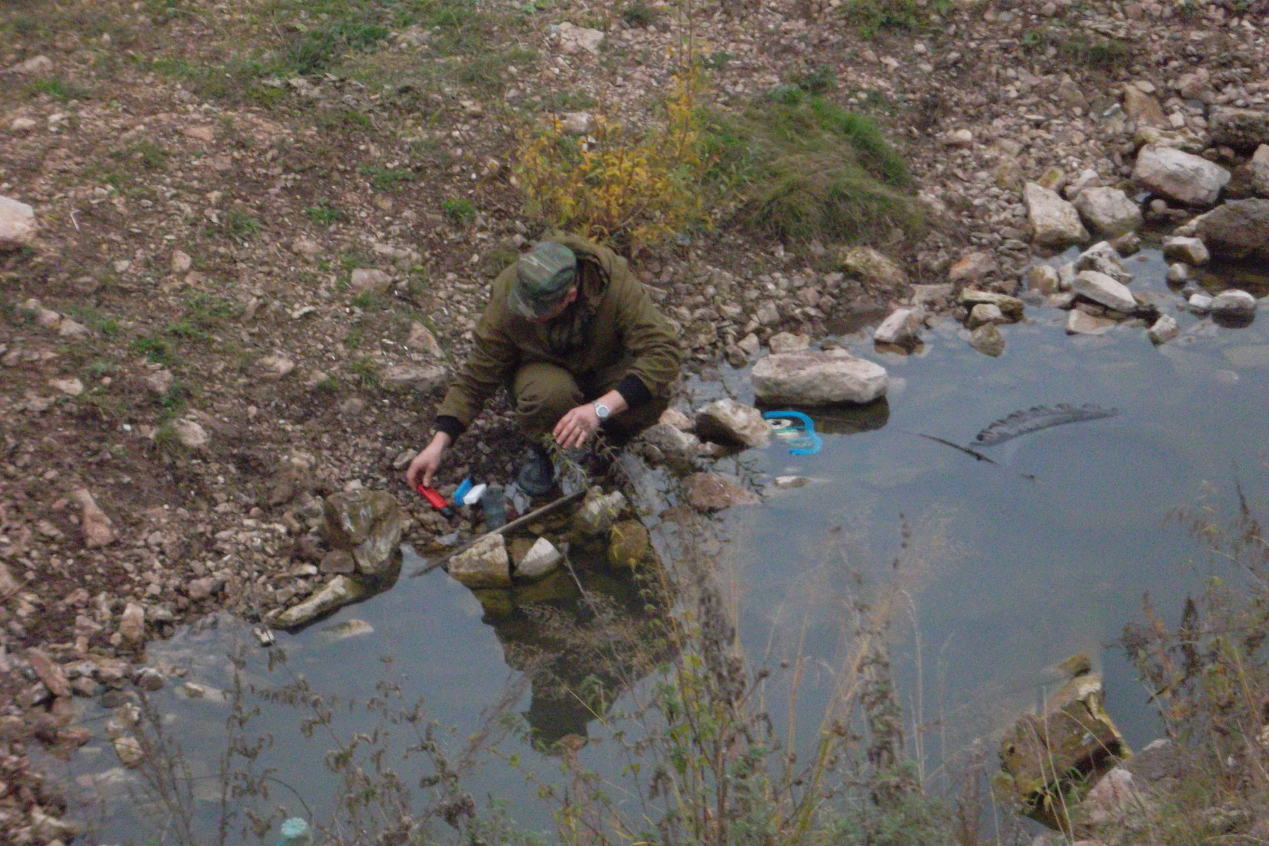
The hydro-gas and geochemical sampling of surface water sources (streams, springs, lakes, and marshes) are carried out in summer in a river. The lead of the hydro-gas and geochemical sampling, on average, is 2-5 km, with a thickening of the sampling network, depending on geological conditions. The water sampling is carried out at one point simultaneously for water-dissolved gases (WDGs), chemical composition, physicochemical properties of waters, helium (radon), hydrogen sulfide, ammonium, and aromatic hydrocarbons. The sampling also involves free gas outputs from the bottom of water bodies and bottom sediments. Water samples for WDG undergo a thermal vacuum degassing in the field sub-base. The hydro-chemical samples for the salt composition of water and physical and chemical properties are selected in 0.5-liter containers and analyzed under field conditions. The analysis of samples is carried out using a field hydro-geochemical laboratory (FHL) while the physicochemical properties of water are measured by field devices (pH-Eh meters, conductivity instrument, and thermometers) directly at the sampling point. The samples for helium are also taken in 0.5-liter containers and analyzed in field conditions using the INGEM-2 instrument.
The method of hydro-geochemical sampling is used to delineate anomalous hydro-geochemical zones, map hidden and explicit groundwater discharge foci, assess the conservation conditions of hydrocarbon accumulations, determine the conductive properties of TWZs and deep snaps. To study the deep hydro-geochemical situation, the following main hydro-geochemical coefficients were calculated: metamorphism, desulfation, iron reduction, water depth, shifted equilibrium of the salt composition of waters, etc..
The hydro-geochemical surveying is used in prospecting for ore and placer deposits, in environmental studies, as well as in the search for mineral, thermal, and radon sources when mapping the discharge zones of deep fluids.